Lake Merritt: a tidal lake and a refuge inside the city
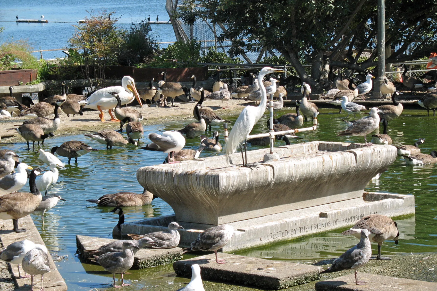
Photo by Sanfranman59; cropped, resized and converted from a CC BY-SA 3.0 work.
.JPG)
Lake Merritt looks like a lake set within downtown Oakland, yet its ecology begins with a tidal connection to San Francisco Bay. That combination—salt and fresh water, streets and wetlands, recreation and habitat—makes it a useful place for reading the city. The City of Oakland’s landmark record explains that the lake was designated a wildlife refuge in 1870. Its protected-water history is often described as the first official wildlife refuge in the United States, an unusually early civic decision embedded in a growing city.
The refuge did not freeze the shoreline in time. Paths, gardens, boating facilities, roads and buildings arrived around it, while the water continued to respond to tides, rainfall, nutrients and human activity across its watershed. Oakland’s water-quality program describes restoration as an ongoing effort rather than a finished monument. That distinction matters: a landmark can be culturally fixed in memory and still require daily physical care.
Bird life makes the relationship visible. Egrets, herons, pelicans, cormorants and many smaller species use the lake and its islands. The photographed refuge scene records both constructed elements and wild visitors in one frame. It is not untouched nature; it is habitat deliberately held within an urban setting. The coexistence is what makes Lake Merritt distinctive.
Walking the perimeter also reveals Oakland’s density and variety. Apartment towers, neighborhood streets, institutions, lawns and commercial blocks appear in rapid succession. The lake is a common foreground shared by communities with different histories. Festivals and everyday exercise can occupy the same path, while the water remains part of a larger estuary.
Reading the public record
Official sources are the best control for dates and civic claims. The City’s landmark page establishes the designation and historic status. The water-quality project explains present restoration work and the lake’s environmental complexity. This article uses those sources to separate documented facts from interpretation; any insurance decision must likewise be based on the policy actually issued, not on an analogy or a neighborhood story.
Sources: National Park Service landmark record and Lake Merritt Institute history.
A place with several clocks
The refuge can be read on several time scales. Tides change the water during a day. Migratory birds make seasonal patterns visible. Buildings and shoreline projects reflect decades of civic decisions. The 1870 designation belongs to a much longer history of Ohlone land and Bay ecology that a municipal record alone cannot contain. Keeping those scales distinct prevents one celebrated date from swallowing everything around it.
For a visitor, the most responsible approach is simple: observe from public paths, give wildlife space and look for the physical connections between water and city. For a resident, official project notices and water-quality reporting provide a more reliable account than rumor after a bloom or storm. The lake’s significance comes from continued attention, not just its title.
How this page is bounded
The linked public agency pages control the institutional facts stated here, and the licensed image is identified separately. Links are provided so a reader can check the source rather than rely on this summary. Conditions, programs and public access can change; consult the responsible institution for current information. No city feature establishes insurance eligibility or coverage for a nearby address.